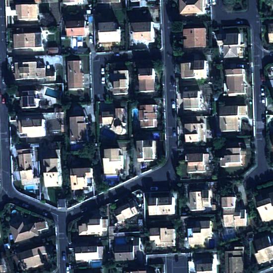
RoofSat is a dataset for representing roofs as wireframes in satellite images. The dataset is composed of 550 images of 550×550 pixels representing urban scene at nadir. They originate from 11 Pleiades Neo satellite Images at 30cm resolution, from which data augmentation has been performed with rotation, scaling, translation, noise, blurring and contrast variation. These images present various types of urban scenes , i.e. residential, urban dense and industrial. The wireframes representing both contours and roof-skeletons of buildings under the form of planar graphs.
Data
This dataset contains four folders of data:
- img: grayscale images from panchromatic satellite images
- img_color: colored images from pansharpened satellite images
- gt: corresponding ground-truth wireframe of images in NPZ format under ‘lines’ key, with [[point1_x, point1_y],[point2_x, point2_y]] formalism for line-segments
- building_masks: corresponding building masks of images
Here is an exemple of each data available for one of the image:
Download
Click HERE to download the dataset (408Mo)
Citation
This dataset is a contribution of the paper ‘LineFit: A Geometric Approach for Fitting Line Segments in Images’ by Marion Boyer, David Youssefi and Florent Lafarge, presented at ECCV 2024. Please refer to this paper if you use the dataset.
Copyright
This dataset can be used for research purposes only. The original Pleiades Neo images are copyrighted by AIRBUS DS.


